Programme
Overview
FOSS4G SotM Oceania 2020 is taking place online on 20 November 2020. We have created an exciting program with you—the FOSS4G and OpenStreetMap community.
Keynote Speakers
An exciting lineup of thought-provoking keynote speakers.
| Speaker | Title |
|---|---|
| Tom MacWright | Ethics in Geo |
| Grayson Cooke | New Uses for Invalid Data: Satellite Imaging and “Path 99” |
| Lesley Arnold | FireWater: A Collaboration between Open Source, government, academia, business, non-for-profit and geospatial communities |
| Nathan Woodrow | How to Win Friends and Work on Open Source |
| Markus Mannheim | What users want |
| Litea Biukoto | OSS in Disaster Risk Reduction in the Pacific Region |
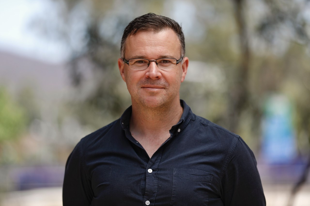
Tom MacWright
Title: Ethics in Geo
Abstract: From the Mercator projection to Google Earth, geospatial technology has always had an ethical component and a close relationship with military and industrial forces. I'll replay the last few decades of development in this world, try to figure out where we are and what we can do about it.
Biography: Tom MacWright spent over a decade in the space of geospatial and visualization technology, leading projects at Development Seed, Mapbox, and Observable. He's a frequent writer and contributor to open source projects.
Grayson Cooke
Title: New Uses for Invalid Data: Satellite Imaging and “Path 99”
Abstract: “Path 99” is an art-science project designed for fulldome planetarium projection. Produced by media artist Grayson Cooke and sound artist Dugal McKinnon, and underpinned by a collaboration with Geoscience Australia and the Digital Earth Australia platform, this project uses satellite images of clouds to explore the weather and landscape of Path 99, an orbit of the Landsat 8 satellite that passes directly down the centre of Australia. In this talk I will provide an “open desktop” outline of the project, focusing on how the project merges GIS applications and processes with artistic and conceptual enquiry.
Biography: Born in New Zealand and based in Australia, Grayson Cooke is an interdisciplinary scholar and media artist, Associate Professor of Media at Southern Cross University. Grayson has exhibited and performed at major galleries and festivals internationally including the Japan Media Arts Festival, WRO Media Art Biennale and Imagine Science Film Festival in New York, and he has published widely in academic journals. He holds an interdisciplinary PhD from Concordia University in Montreal.
Lesley Arnold
Title: FireWater: A Collaboration between Open Source, government, academia, business, non-for-profit and geospatial communities
Abstract: In the summer of 2019/20, destructive bushfires ripped
through New South Wales, eastern and north-eastern Victoria, and Kangaroo
Island in South Australia – burning over 1.8 million hectares of land and
causing loss of life and wildlife. During bushfires, firefighters often
have difficulty sourcing water. In some regional locations, mains water may
not be accessible and firefighters must rely on the static water infrastructure
- swimming pools, tanks and dams - as a vital source of water. The big
question is “where is the water”.
This presentation will show how OpenStreetMap, a SSSI mapathon, an
innovative Firewater App, high-resolution imagery, globally volunteered
geospatial information, artificial intelligence, and a proactive government
can find ‘FireWater’.
Biography: Dr Lesley Arnold is an independent consultant working
with governments to develop strategies, policies and implementation plans
for geospatial information reform, open data initiatives and geospatial
innovation globally.
Lesley currently works with the United Nations and World Bank supporting
countries to strengthen their geospatial information management capabilities
towards implementing the 2030 Agenda for Sustainable Development, and is one
of the lead authors of the UN-GGIM Integrated Geospatial Information Framework.
Lesley has held several executive positions on intergovernmental committees, and
led Western Australia’s fundamental geospatial information program for many years.
She is currently a Board Director for AuScope and SSSI.
Nathan Woodrow
Title: How to Win Friends and Work on Open Source
Abstract: Open source is eating the world, all the cool kids are doing it these days. What does that mean for your own personal and career growth to be involved in open source projects? And what of the people involved? Are your contributions all that matter or is the community an important driver in success
Biography: Nathan is a core QGIS developer and software developer for Chartis Technology. He has been involved as a developer in the QGIS project since 2011 (wow old), but still loves it the same if not more since he has seen it grow into what it is.
Markus Mannheim
Title: What users want
Abstract: News media increasingly understand the importance of interactive story-telling. This is especially the case with data-rich stories — industry research shows audiences are far more engaged with numerical information if it is presented to them visually, and if audiences are allowed to explore it. However, the news industry is amid a financial crisis and increasingly unable to employ developers. At the same time, providers of geodata-visualisation platforms, such as Google and Mapbox, have begun charging substantial fees for high-volume customers like news media. Markus will offer a user-perspective of open-source geodata tools. He will discuss the kinds of visualisation that audiences engage with, the tools that news media are keen to use and some of the barriers to using them.
Biography: Markus Mannheim is a long-time Canberra journalist who has reported on government for 15 years. He now works as a data journalist at the ABC, which employed him as part of its efforts to expand its data analysis and story-telling skills. Markus has studied data analytics but says he is a "journalist who codes a little" rather than a developer.
Litea Biukoto
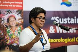
Title: OSS in Disaster Risk Reduction in the Pacific Region
Abstract: Coming Soon
Biography: Litea has been an advocate of Free and Opensource Software and OpenData here in the Pacific and has anchored work develop and launch opendata repository of disaster risk information - the Pacific Risk Information System. Litea is a technical expert of disaster risk assessments in the region which has her involved in a number of technical expert groups including the Technical Working Group on Disaster Statistics in Asia and Pacific and the Technical Expert Group on Comprehensive Risk Management that reports to the Executive Committee of the Warsaw International Mechanism on Loss and Damage.
Friday
| Time (UTC) - To be confirmed | Track 1 - To be confirmed |